
 Although landscape architecture is a relatively new field in Romania, taking into account that barely in 2014 the landscape architect appeared in the nomenclature of jobs, various responsibilities fall on the shoulders of professionals, from identifying solutions to reduce carbon emissions to improving the urban environment, according to RomaniaJournal.ro.
How can satellite data facilitate better tree maintenance? How can connectivity improve parks, sports fields, forests and urban farms? Or how green are cities around the world, really? Such topics were addressed at Living City – the international conference organized by Husqvarna this year, in a digital format, where there were talks on the subject of the sustainability of future green spaces. During the event, professionals and scientists shared their knowledge and presented their ideas on the future of sustainable (urban) ecological maintenance and tree care around the world.
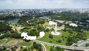
Also, during the event, Husqvarna revealed their latest top technologies that will make their appearance on the Romanian market, such as HUGSI – Husqvarna Urban Green Space Index – an AI satellite solution that quantifies the greenery of cities around the world by observing green spaces – by above, in order to ensure and improve the growth and maintenance of green spaces in urban areas.
How green are the cities really?
Analyzing the lands in urban areas and segmenting them into three categories: vegetation (trees and plants), water and others (houses, roads) HUGSI shows that:
- Global urban areas are 39% green
- The greenest are the urban spaces in European countries: 45% green spaces.
- Latin America and South and West Asia have the least green space – 29% respectively
Read more HERE


